
The Valley of Sinni and Mercure
In Earth Cinema by Anish Kapoor, the contact with the land is essential. This monumental sculpture shows the relative nature of the human, physical and historical dimensions. The concept of ‘depth’ is important and can be explored from different points of view: a geological one, as it reminds us about the soul of the land and stratifications; an historical one, relating to human settlements in the region; and, finally, a conceptual one, because it promotes a participated movement that enables us to travel back in time and then return to the present days, with renewed knowledge and awareness.
Starting from the concepts of stratification and unique insight, we identified the key places of the area, the ones that tell the most about the interaction between nature and men. The villages of Latronico, Castelluccio Superiore and Viggianello are the backdrop of the story.
There are three levels of narration: the first represents the ancient and the deep, morphological erosion and prehistoric sites; the second is about human settlement and the interaction between men and the land, which gives rise to gastronomy, farming landscape, and historical centres; the third level is about men discovering nature, the mountain protected by the Park.
Our journey starts from Latronico, a village that stands out on a vast horizon, 3 km away from the Sinnica area, rich in precious environmental resources. Protected by the rocky Mount Alpi (1,900 m), it guards the shady stillness of the beechwood of Fagosa, the Malboschetto, where wild animals, such as the wolf, live. The mountain routes, from Piana fiorita to Teduri, are dotted with small fountains: these routes are ideal for trekking, with panoramic views over the gorges, ravines and ancient marble quarries. Downstream, abundant thermal spring water comes from the Calda (which means ‘hot’) water source (23° C), known, since the ancient times, for its healing properties.
In Latronico, we have thought of two ideal itineraries to enhance the peculiarity of the land and the meaning of Anish Kapoor's work. The first itinerary, which is mostly related to nature, starts from contrada Iannazzo; under a stone quarry, at 980 m above sea level, you can see a fossil of Istiophoridae, of 235 cm in length from the rostrum to the caudal fin, and 95 cm in height from the dorsal to the ventral fins. To get there, take road SS 104. The route leads to one of the most important viewpoints, Mount Alpi, from whose peaks, when weather conditions are good, you can see the Tyrrhenian coast and the main peaks of Cilento area, to the west; the Val d’Agri area to the north; the Pollino massif to the south and the complex system of clay gullies known as ‘Calanchi’, descending to the Ionian Sea, to the south.
From the slopes of Mount Alpi, a trail leads to the heart of Malboschetto wood. The beechwood, known as ‘Fagosa’ by its inhabitants, is the ideal place to cool off during the summer heat, as the forest canopy is so dense that only a few sun's rays can penetrate through the gaps. After having admired the natural beauties, the first part of the route ends in the most ancient inhabited settlement of Latronico.
The historical centre is characterised by poor architecture; houses are leaning one against the other to form an amphitheatre. The streets are winding and narrow and only one, via Dante Alighieri, goes through the entire historical centre, starting from Umberto I square and reaching up to the Church of Sant'Egidio. On Via Dante there are the palaces that in the past were considered as the most beautiful, with their portals in carved stone.
The second route starts from the Caves of Calda. These five caves, located in Calda, are very important for prehistoric studies in Southern Italy, in particular the period between the Mesolithic (8000 BC) and the Bronze Age (1300 BC). In Calda we also have the chance to visit three small museums and start a journey through the history of Latronico’s civilisation. They are the Civic Archaeological Museum, the Musuem of Spa and Wellness and the Museum of the Peasant Culture.
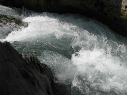
The important Thermal Baths of Latronico are easily accessible from this point. From the thermal spa, you can reach Sinni river, which originates at 1,380 m above sea level from Serra della Giumenta, on the eastern slope of Mount Sirino.
Two different routes start from this point:
the first road runs along the river, across a bridge, following the path that connects contrada Preti with Castelluccio Superiore, leading to Peschiera torrent’s valley and, finally, to Bosco Magnano. Peschiera torrent is another key point, as it is very rich in water sources and Hygrophila plants, commonly known as swampweeds. The vegetation here boasts a variety of species: Turkey oak, Beech, Alder and Poplar. The most important animal species include the otter, the deer, the spectacled salamander, the green woodpecker and the black squirrel. Between 1860 and 1870, the area was the setting of bloody episodes linked to brigandage.
The second road leads to the main, suggestive streets of Latronico, up to the town centre. The second step of our journey takes us to another village, at the heart of Pollino: Castelluccio Superiore. Anish Kapoor's artwork is our guide through an ‘insider journey’, across the human, physical and historical dimensions.
It starts from the so-called Laure del Mercurion, natural caves where Basilian monks settled around the year 1000, which present clear signs of human ‘intervention’. They can be accessed through the ancient Roman road, Via Popilia, made in dry stone.
The same road leads to one of the most impressive works of the southern Italian railways: one helical gallery, incorporated in the 16 km railway route that once connected Prestieri to Laino (the first village in Calabria region).
Our journey leads to the historical centre of Castelluccio Superiore, through alleys and narrow streets, up to the first viewpoint, the ruins of the castle, where a superb panorama of the Mercure’s valley offers a 360° view on the peaks of the central Pollino massif.
This part of the itinerary ends with a visit to the Steles, surrounded by myths and legends of the pagan world. Popular legends tell that this seven, ancient, calcareous stones, half-moon shaped, are the symbol of a source of water. The mystery around the Steles, and the different meanings they have been given over time, takes us back to the historical periods that marked our region.
A trail leads to the Sanctuary of the Madonna del Soccorso, at 1,100 m above sea level; from here, the peak of Mount Zaccan, 1,680 m asl and natural habitat of the impressive Bosnian Pine, can be accessed.
Viggianello is our next destination, with its important natural, historical and cultural heritage, that well illustrates the history of our land. The historical continuity of these places also symbolises their cultural continuity; as a matter of fact, as it is in Castelluccio Superiore, the first point of interest are the hermitages, known as ‘Laure’: a positive sign of the relationship between men and the region.
Going up to the historical centre, through narrow streets reserved for pedestrian-only use, you arrive at the medieval castle, whose terraces offer a view on the highest peaks of the central Pollino massif.
This area, where men have always had special care for nature, is rich in water sources such as the one that gives its name to the entire valley: the Mercure's source, the last stop of our tour.
The Valley of Frido
Nestled within the heart of the Pollino National Park, the Valley of Frido boasts a rich and varied vegetation and is intersected, for its entire length, with the river Frido and its tributaries.
Gentle slopes and lush valleys unfold from the river sources to the valley. The five giants of the Pollino mountain chain dominate the valley, marking the border between Calabria and Basilicata regions. Wide areas and landscapes of bewitching beauty stretch as far as the eye can see.
Going up the valley, after Bosco Magnano wood, at 900 m asl and in a central location with beautiful views, there is the village of San Severino Lucano.
In the past, this territory belonged to the feud of San Severino, which gives it its name. The first inhabited centre was built around the 15th century thanks to the expansion of agricultural colonisation carried out by the Abbey of Saggittario. In 1806, the village of San Severino, which until then formed part of Chiaromonte's territory, became a Municipality, following the new Napoleonic organisation; in 1820 the adjective “Lucano” (from Lucania, the ancient name of Basilicata region) was added to the name. After the Italian Unification (1860), brigandage was a widespread phenomenon in the surroundings of the village, as it was favoured, as in the entire Pollino area, by the presence of inaccessible mountains, and the lack of infrastructures and roads. Numerous place names indicate this phenomenon (for example, the “Fosso del Brigante”, which literally means the ‘hole of the brigand’), but above all the historical figure of Captain Iannarelli is recalled, as he committed bloody massacres and executions, even of civilians. Extensive remains about his life are still kept today: his house in the village and the mill/sawmill located in Mezzana. Due to its recent history, the centre of San Severino doesn’t have places of architectural interest, except for the Abbey of Saggitario, near Chiaromonte. The urban layout of the historical centre, which developed spontaneously, mostly includes terraced housing on the main street. The main church, dedicated to Maria SS. degli Angeli, and probably dating back to the first inhabited centre, lies in the town centre and maintains its eighteenth-century layout.
The church of San Vincenzo stands on the upper part of the village. The church, in particular the façade, keep their original structure; inside there is a wooden crucifix of the 6th century. Walking around the town centre, you can see beautiful stone portals, dating back to the second half of the 19th century, and buildings of the same period, as well as the typical alleys that characterise all mountain villages. The three fountains, located in the lower part of the village, are also worth a visit. The area boasts beautiful natural landscapes and industrial heritage sites, such as the mills. The views of Bosco Magnano wood from the Valley of the Sinni, and the Peschiera and Frido streams, are breathtaking.
Circular paths: game, memory, places.
The Pollino National Park is rich in charming places, stretching to the horizon, where back memories can be retraced.
The itinerary we want to create goes from the circular movement of the millstones, once very popular in this area, to the circular movement of the RB Ride carousel, made by the artist Carsten Höller and reminding of playful games.
The artwork is particularly fascinating because it was spontaneously and unconsciously placed, by the artist, in an area with very special value for its inhabitants, as it's linked to a sad story occurred to some kids in the 1940s.
The landscape, together with the strength of memory and the power of emotions, will always be of great charm for all visitors. The itinerary links the contemporary artwork to the actual locations and their inhabitants, transposing everything into a metaphorical story using game, moments of levity, joy and movement. The installation finds a connection with the history of that place, offering the possibility of experiencing simultaneously what seems to be in contrast to each other: sky and ground, joy and sorrow.
The itinerary starts in Cropani, a tiny hamlet of San Severino Lucano and heads towards the Fasanelli mill, located where the Peschiera stream converges into the Frido river, downstream of the ruins of “Saggittario”, an ancient monastery founded by the Cistercians in 1270.
The journey continues with a visit to the Cornalonga Mill, once also used as a fulling mill and silk mill, and with the Magnacane Mill, near Viggianello.
The main feature of the itinerary is its circularity, which recalls the movement of mill wheels, and the opposition (closed-open) between the landscapes that unfold before the eyes of the travellers entering the enchanting scenery of Bosco Magnano wood, with its mysterious rocky monuments dug out by the water. The wood is a dreamy landscape where the sky ends and the ground begins, and where dark and light, silence and noise, merge into one. This place has always been home to quiet and almost invisible otters.
Beautiful natural landscapes make way for a dfferent set of surroundings: we are in the municipality of San Severino Lucano.
Then, the itinerary reaches Visciglie, in the upper part of San Severino Lucano, offering views on a well-maintained oak forest. The trail goes uphill, through a reforestation area, leading to Timpa della Guardia (1,1169 m), a plateau offering, during the whole journey, spectacular views from the Valley of Frido to Mount Pollino (2,248 m), up to Montecotugno Dam. At the end of the trail, travellers frequently see squirrels, with black fur and white underside, climbing on ancient conifers.
The end of this wonderful journey through nature and memory in the Pollino National Park is the visit to the Timpa della Guardia, where the RB Ride installation by Carsten Höller is located. The landscape here is surreal and characterised by the circularity of the carousel’s movement, placed in such a way to offer visitors opposite views: thick woods and panoramic view points, suggesting an alternation of opposing moods, from joy and wonder to introspective moments.

Val Sarmento
In Basilicata, within some suggestive scenery of the Pollino National Park, there is a place where the continuous water flow creates an itinerary rich in culture, history and landscapes: the valley of Sarmento. Here, natural and artificial flows are intertwined; water courses intersect with one another and different cultures combine with each other in the daily life.
This scenery becomes the backdrop of contemporary art events thanks to the ambitious “Arte Pollino Un Altro Sud” project. The site was chosen by the artist Giuseppe Penone to create a one-of-a-kind artwork: the “Nature Theatre”, where nature becomes theatre itself.
The whole itinerary is permeated with a constant contamination between man and nature.
Our journey starts in Senise, from the privileged view point of the great barrier of Montecotugno artificial lake. The dam, built between the seventies and the eighties to supply water to Metaponto area and Puglia region, can contain over 500 million cubic metres of water and, thanks to its barrier of a lenght of almost 2 Km, is one of the most imposing earth-fill dam in Europe.
On the right bank, a scenic route, where visitors can walk or cycle, is immersed in orchards and vineyards. A bird observatory is surrounded by the Mediterranean vegetation, oaks and mastic trees. The building, built by the Pollino National Park's managing body, is a study and research centre for the numerous species of the area: owls, herons, egrets, woodpeckers, blackbirds, real kites and crows. This charming location overlooks the surroundings and offers a wide panorama: a hermitage immersed in the silence of nature, which is in close contact with itself and men. The ancient road SS 92, through hairpin turns and old farms that guard rural memories, leads to the discovery of very different landscapes, a prelude for the Valley of Sarmento: the Timpe of Noepoli, known as the “small Canyon".
The Timpa Forata, with its peculiar shape created by erosion of the atmospheric agents on sandy formations, stands out majestically. The landscape dominated by the Timpa is a border landscape, a boundary between two valleys: the valley of Sinni and the valley of Sarmento, which can be accessed through the old gallery of road SS 92, a true “photographic lens" that captures, as in a voluntary pose, the peak where the village of Noepoli stands. The ancient State of Noia, called in this way since 1500 with the advent of Fabrizio Pignatelli, belongs to a territory where settlements had already started in the 8th century BC. The town centre dates back to the 7th century.
Upstream of the village of Noepoli there is the panoramic view point of "La Torretta", offering a wide panorama on the Sarmento valley, as a great natural stage. Downstream there is the river of Sarmento, chosen by Giuseppe Penone for his “Nature Theatre”. This point offers views on the natural water flow, which is branched and then joined again, creating a twist in the path that can be compared to the ‘twist of cultures’ that, over the centuries, has made the valley of Sarmento the cradle of different civilisations. The cultural identity that stands out the most is the Arbëreshë one.
Theatre: the place of representation
Representation becomes everyday life. Everyday life becomes representation.
We are in San Costantino Albanese and San Paolo Albanese, two tiny villages characterised by a strong and preserved identity linked to the Arbëreshë culture, brought by Albanians fleeing their homes in the second half of the 16th century. Their identity continues to resist to the erosive action of time and is displayed in the Museum of the Arbëreshë Civilisation, in San Paolo Albanese, and the Ethnic Museum of the Arbëreshë Culture in San Costantino Albanese.
A culture that protects its past, whose symbol is the traditional dress. The Arbëreshë community in the Valley of Sarmento has got strong bounds with the Greek-Byzantine rite; one of its important parts is the wedding ceremony, among the most interesting rituals of the Arbëreshë civilisation. The entire village becomes a ‘living museum’, a theatre where bewitching characters that seem to come from a faraway world, act.
The itinerary continues upwards: Terranova del Pollino, with its Timpa Delle Murge, where the history of human culture becomes even more ancient. The “Casa del Conte” is the ideal starting point to reach the Timpa: this area is rich in accommodation facilities, as it is very popular among tourists. Visitors receive a warm welcome and it's still possible to enjoy an authentic family atmosphere. The place is only a prelude for the stunning spectacle of nature in Timpa Delle Murge, the last stop of our itinerary.
Travellers will have the chance to walk on pieces of oceanic crust, which formed millions of years ago. The landscape is varied, immersed in beautiful wild nature. Your sense of sight won’t be enough to enjoy this whole experience, which requires all the senses. It's the ‘obvious’ ending to the journey that the tourist/actor makes along this route, taking with themselves the magic of the experience, the wonder of discovery and the spectacle of nature.